Pedernales Province (Provincia de Pedernales)
 |
The capital of the province, Pedernales, was originally called Juan López, who was a Spanish inhabitant who had settled in the area around the 19th century.
The province was called Pedernales after the river located on the border with Haiti, in which flint is abundant. The indigenous people of the Dominican Republic, the Taíno, used them to make sharp tools, such as axes and arrowheads.
The province of Pedernales is located in the southwest of the Dominican Republic, sharing its borders with the neighboring Haiti. It is located 330 km (kilometers) from Santo Domingo, the Dominican capital. It is part of the region called Enriquillo, and it is the seventh largest province in the country, with 2,042.40 km2 (square kilometers). It borders the province of Independencia to the north, and the province of Barahona to the east.
Pedernales is located in a geomorphological region known as Procurrente de Barahona. The area of Pedernales has some of the most arid lands in the country. It is formed by successive marine terraces. The lowest part of these is on the edge of the coast, less than 100 m s. n. m. (meters above sea level). As one moves away from the sea, the elevations grow to 400 m. Upon entering the north, the ground continues to rise up to the Sierra de Bahoruco. Mount Vincent, with an elevation of about 2046 m, is the highest point of the province.
The territory of Pedernales has several adjacent lands, such as Isla Beata, Isla Los Frailes, Alto Velo Island, and Cayo Piedra Negra making it a strategic place for fishermen. Historically it was considered important, as it served as an orientation for Spanish and French ships during the colonial era that wanted to reach the Western expanse of the island. In addition, its natural conditions allow the nesting of seabirds and other endemic species.
Map - Pedernales Province (Provincia de Pedernales)
Map


Country - Dominican_Republic
 |
 |
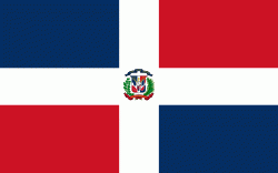
| Flag of the Dominican Republic | |
The native Taíno people had inhabited Hispaniola before the arrival of Europeans, dividing it into five chiefdoms. They had constructed an advanced farming and hunting society, and were in the process of becoming an organized civilization. The Taínos also inhabited Cuba, Jamaica, Puerto Rico, and the Bahamas. The Genoese mariner Christopher Columbus explored and claimed the island for Castile, landing there on his first voyage in 1492. The colony of Santo Domingo became the site of the first permanent European settlement in the Americas and the first seat of Spanish colonial rule in the New World. It would also become the site to introduce importations of enslaved Africans to the Americas. In 1697, Spain recognized French dominion over the western third of the island, which became the independent state of Haiti in 1804.
Currency / Language
| ISO | Currency | Symbol | Significant figures |
|---|---|---|---|
| DOP | Dominican peso | $ | 2 |
| ISO | Language |
|---|---|
| ES | Spanish language |